kingston

Lake Ontario Park

Dawson Point dock on Wolfe Island in winter

Rodden Park near An Clachan (Queen's University's Apartment Complex), Kingston, Canada

JDUC

KP trail follows old railway road bed.

1000 King Street

Little Cataraqui marsh

Rockwood Asylum a fomer psychiatric hospital. Built starting in 1862, completed in 1870 using convict labour from Kingston Penitentiary. It housed the ciminally insane until 1877 after which they were housed at K.P. The province assumed responsibliity for the insane in 1877.

Red Sky's at Night Sailors Delight.

This was built in 1886 as a Grand Trunk Railway's (GTR) Hanley station, later became CNR. Ontario Street was a dirty industrial district with shipbuilding and locotomtive works until 50 years ago. The GTR provided the first company pension in Canada in 1874. It started when you were age 70, it wasn't much, the average life expectancy was 55. Today, 40 % of workers have pensions, many private ones are badly underfunded. We do have universal national pensions now.

Former Bajus Brewery with oak barrels built into the wall near the top. The 3 story part was built in 1861, the south wing may day back to 1794 making it one of the oldest structures in Ontario. In 1842 Kingston had 136 licensed taverns and a population of about 8,500 people.

low train trestle over wetlands, looking North

Skuttled schooner on Garden Island. One of a dozen in the Kingston area, visible in the fall at low water levels and when the water is the clearest. It is all below water in the summer. Over 150 years old. One of about 80 boats operating out of Kingston which were no longer needed when the rail way began in 1855.

Rideau Trail, Kingston to Ottawa

Cedar Island, part of the Thousand Island National Parks. It has a sheltered cove and sturdy docks for boats.

Rideau Trail board walk looking north

You can admire the golf club property as you also enjoy a nature hike. Late spring.

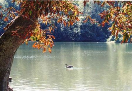
A beautiful place for senior citizens and families to stroll through a mature forest, near the city. The only honking you hear is geese flying overhead.

7101404.jpg

Cathcart Redoubt and Fort Henry in the distance.

Whitney Manor, built in 1817 of limestone. There were only about 300 houses in Kingston at that time. It would have been a full hours walk each way and a ferry ride across the Cataraqui River. It would have employed a person full time just getting enough fire wood for the winter.

76671145.jpg

The Rideau Trail goes from Kingston to Ottawa through here. Just follow the orange arrows to Ottawa, or the yellow tipped orange ones to Kingston. Maintained by volunteers of the Rideau Trail Association. They are mostly senior citizens too.

One of many new large houses along this shore.

The Rideau Trail. It's not Cathedral Grove on Vancouver Island, but it is close to home.

Little Cataraqui Creek Conservation Area visitor centre, open all year. There are hiking and ski trails, a sugar bush, skating on the lake and more. Cost is $5.50 per person.

Princess Street @ Division

This fine old maple is probably the mother tree for many of the others around.

Chalmers United

Rockwood House built in 1842 for John Cartwright. Designed by George Brown who designed Kingston City Hall. It is stucco on stone. Now use by the Ministry of Municipal Affairs and Housing. It would have been heated with wood before 1871, and municipal water was not available in this area until then too.

All the shore line around Snake Island is covered with water foul. It is also foul smelling down wind.

The Kingston Rowing Club in training. They have won many awards. Four men won silver in the Olympics in 2012.

Sunken schooner in Dead Man's Bay in very shallow water. Best seen in the fall when the water levels are low and the water clear. No diving needed. About 50 m. from the very end of the bay.

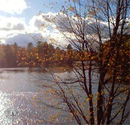
Sometimes there are a lot of water birds at this view point on the Little Cataraqui Creek.

Spring Ice (Kingston, Ontario)

Fortress by the Waterside

Storm tossed waves, ice and spray coat the cars at the Dawson Point dock on Wolfe Island.

Park

Rockwood Asylum, a former psychiatric hospital, viewing west. It was built starting in 1862 and completed in 1870, it was occupied as sections were ready, and closed in 1959. It had it's own coal dock to import Pennsilvania coal via Oswego N.Y. for heating.

This foot bridge in the Little Cataraqui Conservation area can be seen from the 401 highway.

A picnic area along the interior road. Sometimes the gate for car access is closed.

Part of a former tannery, not very beautiful, but designed for a job. Built about 1845. The main loading entrance is on the other side, but it is obstructed by trees.

Metal ship wreck revealed at low water, fall of 2012, behind the Woolen Mill on Molly Brant Point. It's history is unknown, but the wreck is known as BbGc-42.

Low water uncovers artifact

Two skuttled schooners revealed at low water. Fort Henry in the background. One has a lot of steel refinforcing rods sticking up, they are just below the surface in the summer. The water is 0 to 2 m. deep over a wide area..

A fine limestone house built into the hill side. the end wall projecting above the roof line is not unusual for these houses.

Nine Mile Point Lighthouse-Simcoe Island
Photos provided by Panoramio. Photos are under the copyright of their owners.