切换导航
澳大利亚
有关此
国家
不丹
东帝汶
中国
中非共和国
丹麦
乌克兰
乌兹别克斯坦
乌干达
乌拉圭
乍得
也门
亚美尼亚
以色列
伊拉克
伊朗
伯利兹
佛得角
俄罗斯
保加利亚
克罗地亚
关岛
冈比亚
冰岛
几内亚
几内亚比绍
列支敦士登
刚果共和国
刚果民主共和国
利比亚
利比里亚
加拿大
加纳
加蓬
匈牙利
北马里亚纳群岛
南非
博茨瓦纳
卡塔尔
卢旺达
卢森堡
印度
印度尼西亚
危地马拉
厄瓜多尔
厄瓜多尔
厄立特里亚
叙利亚
古巴
台湾
吉尔吉斯斯坦
吉布提
哈萨克斯坦
哥伦比亚
哥斯达黎加
喀麦隆
图瓦卢
土库曼斯坦
土耳其
圣卢西亚
圣基茨和尼维斯
圣多美和普林西比
圣文森特和格林纳丁斯
圣皮埃尔岛和密克隆
圣诞岛
圣赫勒拿
圣马力诺
圭亚那
坦桑尼亚
埃及
埃塞俄比亚
基里巴斯
塔吉克斯坦
塞内加尔
塞尔维亚
塞拉利昂
塞浦路斯
塞舌尔群岛
墨西哥
多哥
多米尼加
多米尼加共和国
奥地利
委内瑞拉
孟加拉国
安哥拉
安圭拉
安提瓜和巴布达
安道尔
密克罗尼西亚联邦
尼加拉瓜
尼日利亚
尼日尔
尼泊尔
巴哈马,
巴基斯坦
巴巴多斯
巴布亚新几内亚
巴拉圭
巴拿马
巴林
巴西
布基纳法索
布隆迪
希腊
帕劳
库克群岛
开曼群岛
德国
意大利
所罗门群岛
托克劳
拉脱维亚
挪威
捷克共和国
摩尔多瓦
摩洛哥
摩纳哥
文莱
斐济
斯威士兰
斯洛伐克
斯洛文尼亚
斯瓦尔巴特群岛
斯里兰卡
新加坡
新喀里多尼亚
新西兰
日本
智利
柬埔寨
格恩西岛
格林纳达
格陵兰
格鲁吉亚
比利时
毛里塔尼亚
毛里求斯
汤加
沙特阿拉伯
法国
法属圭亚那
法属波利尼西亚
法罗群岛
波兰
波多黎各
波斯尼亚和黑塞哥维那
泰国
泽西岛
津巴布韦
洪都拉斯
海地
澳大利亚
澳门
爱尔兰
爱沙尼亚
牙买加
特克斯和凯科斯群岛
特立尼达和多巴哥
玻利维亚
瑙鲁
瑞典
瑞士
瓜德罗普岛
瓦利斯群岛和富图纳群岛
瓦努阿图
留尼汪
白俄罗斯
百慕大
皮特凯恩群岛
直布罗陀
福克兰群岛(即马尔维纳斯群岛)
科威特
科摩罗
科特祖`象牙
科科斯(基林)群岛
秘鲁
突尼斯
立陶宛
索马里
约旦
纳米比亚
纽埃
维尔京群岛(美国)
缅甸
罗马尼亚
美国(美国)
美属萨摩亚
老挝
肯尼亚
芬兰
苏丹
苏里南
英国
荷兰
荷属安的列斯
莫桑比克
莱索托
菲律宾
萨摩亚
葡萄牙
蒙古
蒙特塞拉特
西撒哈拉
西班牙
诺福克岛
贝宁
赞比亚
赤道几内亚
越南
阿塞拜疆
阿富汗
阿尔及利亚
阿尔巴尼亚
阿拉伯联合酋长国
阿曼
阿根廷
阿鲁巴
韩国,北美
韩国,南美
香港
马其顿,前南斯拉夫共和国
马尔代夫
马拉维
马提尼克岛
马来西亚
马约特
马绍尔群岛
马耳他
马达加斯加
马里
黎巴嫩
黑山共和国
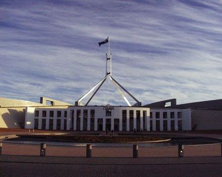
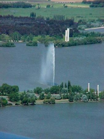
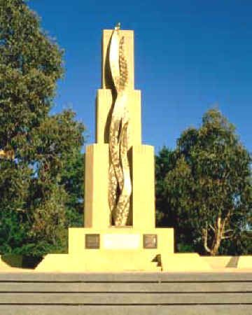
坎培拉
有关此
城市
Bundaberg
Traralgon 重审
伍伦贡
伯斯
凯恩斯
凯瓦拉海滩
吉隆
图文巴
坎培拉
塔姆沃思
墨尔本
奥尔伯里沃东加
奥尔巴尼
巴利纳
巴拉来特
布里斯本
德文波特
悉尼
戈斯福德
拜伦湾
朗塞斯顿
本迪戈
杰拉尔顿
格莱斯顿 Tannum 金沙
橙色
汤斯维尔
沃加沃加
珀斯的 3
班伯里
科夫斯港
米尔迪拉-温特沃什
纽卡斯尔
罗克汉普顿
荷伯特
谢珀顿 Mooroopna
贝尔德湾
赫维湾
达尔文
阿得雷德
雷文斯霍
马凯
麦夸里港
免费刊登
接触
布鲁克皇家空军基地
澳大利亚
List of airports 澳大利亚
布鲁克皇家空军基地
机场有关的信息 - 布鲁克皇家空军基地, 澳大利亚
说明
价值
国际航空运输协会
(国际航空运输协会机场代码)
没有国际航空运输协会代码
类型
直升机场
当地机场代码
-
GPS 机场代码
YGNB
经度
-33.7633018493652
纬度
150.636993408203
附近的城市 布鲁克皇家空军基地, 澳大利亚
城市国家
距离 (公里)
悉尼
50.13 km
戈斯福德
74.99 km
附近的图片 布鲁克皇家空军基地, 澳大利亚
图片 布鲁克皇家空军基地
信息材料 - 坎培拉
生活费用的价格 坎培拉
时间 坎培拉
时区 - 坎培拉, 澳大利亚
天气 - 坎培拉, 澳大利亚
堪培拉地图
国旗 澳大利亚
坎培拉 - 电话代码, 如何调用 坎培拉
图片 坎培拉
坎培拉, 澳大利亚 的距离
信息材料 - 澳大利亚
货币 澳大利亚, 澳大利亚元
汇率计算器 澳大利亚元
大使馆 澳大利亚
澳大利亚地图
机场名单 澳大利亚
照片廊
澳大利亚, 坎培拉
添加您的照片
图片 坎培拉 »