トグル ナビゲーション
イギリス
これについての詳細
国
アイスランド
アイルランド
アゼルバイジャン
アフガニスタン
アメリカ合衆国(USA)
アラブ首長国連邦
アルジェリア
アルゼンチン
アルバ
アルバニア
アルメニア
アングィラ
アンゴラ
アンチグアバーブーダ
アンドラ
イエメン
イギリス
イスラエル
イタリア
イラク
イラン
インド
インドネシア
ウガンダ
ウクライナ
ウズベキスタン
ウルグアイ
エクアドル
エジプト
エストニア
エチオピア
エリトリア
エルサルバドル
オマーン
オランダ
オランダ領アンティル
オーストラリア
オーストリア
カザフスタン
カタール
カナダ
カメルーン
カンボジア
カーボベルデ
ガイアナ
ガボン
ガンビア、
ガーナ
ガーンジー島
キプロス
キューバ
キリバス
キルギスタン
ギニア
ギニアビサウ
ギリシャ
クウェート
クック諸島
クリスマス島
クロアチア
グアテマラ
グアドループ島
グアム島
グリーンランド
グルジア
グレナダ
ケイマン諸島
ケニア
ココス(キーリング)諸島
コスタリカ
コモロ
コロンビア
コンゴ共和国
コンゴ民主共和国
コートジボワール `voire
サウジアラビア
サモア諸島
サン·マリノ
サントメプリンシペ
サンピエール·ミクロン島
ザンビア
シエラレオネ
シリア
シンガポール
ジブチ
ジブラルタル
ジャマイカ
ジャージー
ジンバブエ
スイス
スウェーデン
スバールバル諸島
スペイン
スリ·ランカ
スリナム
スロバキア
スロベニア
スワジランド
スーダン
セイシェル
セネガル
セルビア
セント·ヘレナ島
セントクリストファーネイビス
セントビンセントおよびグレナディーン諸島
セントルシア
ソマリア
ソロモン諸島
タイ
タジキスタン
タンザニア
タークスカイコス諸島
チェコ共和国
チャド
チュニジア
チリ
ツバル
デンマーク
トケラウ
トリニダード·トバゴ
トルクメニスタン
トルコ
トンガ
トーゴ
ドイツ
ドミニカ
ドミニカ共和国
ナイジェリア
ナウル
ナミビア
ニウエ
ニカラグア
ニジェール
ニューカレドニア
ニュージーランド
ネパール
ノルウェー
ノーフォーク島
ハイチ
ハンガリー
バヌアツ
バハマ、
バミューダ
バルバドス
バングラデシュ
バージン諸島(アメリカ)
バーレーン
パキスタン
パナマ
パプアニューギニアの
パラオ
パラグアイ
ピトケアン諸島
フィジー
フィリピン
フィンランド
フェロー諸島
フォークランド諸島(マルビナス諸島)
フランス
フランス領ポリネシア
ブラジル
ブルガリア
ブルキナファソ
ブルネイ
ブルンジ
ブータン
プエルトリコ
ベトナム
ベナン
ベネズエラ
ベラルーシ
ベリーズ
ベルギー
ペルー
ホンジュラス
ボスニア·ヘルツェゴビナ
ボツワナ
ボリビア
ポルトガル
ポーランド
マカオ
マケドニア旧ユーゴスラビア共和国
マダガスカル
マヨット島
マラウイ
マリ
マルタ
マルティニーク島
マレーシア
マーシャル諸島
ミクロネシア連邦
ミャンマー
メキシコ
モザンビーク
モナコ
モルディブ
モルドバ
モロッコ
モンゴル国
モンテネグロ
モントセラト
モーリシャス
モーリタニア
ヨルダン
ラオス
ラトビア
リトアニア
リヒテンシュタイン
リビア
リベリア
ルクセンブルク
ルワンダ
ルーマニア
レソト
レバノン
レユニオン
ロシア
ワリー·エ·フトゥーナ
中国
中央アフリカ共和国
仏領ギアナ
北マリアナ諸島連邦
南アフリカ
台湾
日本
東ティモール
米サモア
西サハラ
赤道ギニア
韓国
韓国、北朝鮮
香港
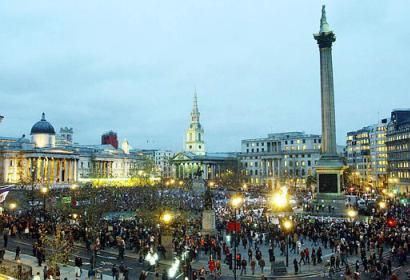
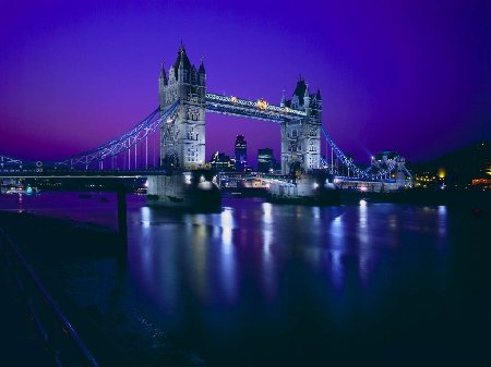
ロンドン
これについての詳細
都市
Keynshamの
アバディーン
インバネス
ウェストンスーパーメア
エディンバラ
クリフ
グラスゴー
ケズウィック、カンブリア
コベントリ
コルチェスター
サンダーランド
サンドウェル
シェフィールド
シャフツベリー
タンブリッジウェルズ
ダービー
チェルトナム
チッピングソドベリー
ドーバー ケント
ノッティンガム
バリー ・ セント ・ エドマンズ
バル ミル、ヘクサム
バース
バーミンガム
ブライトン
ブラッドフォード
ブリストル
ブリッ
プリマス
ベルファスト
ボルトン
ポーチコール - ウェールズ
マイステグ - ウェールズ
マンチェスター
ミルトンケインズ
ヨーク
リバプール
リーズ
レスター
ロンドン
三重県
自由なリスト
コンタクト
RAFボルトヘッド
イギリス
List of airports イギリス
RAFボルトヘッド
空港についての情報 - RAFボルトヘッド, イギリス
説明
値
IATA
(国際航空運送協会空港コード)
Iata 航空会社コード
タイプ
閉鎖した空港
地元の空港コード
-
GPS の空港コード
経度
50.2238448841
緯度
-3.801612854
近くの都市 RAFボルトヘッド, イギリス
市、国
距離 (km)
プリマス
30.13 km
近くで写真 RAFボルトヘッド, イギリス
の写真 RAFボルトヘッド
報知的な材料 - ロンドン
物価、生活費 ロンドン
での時間 ロンドン
時間帯 - ロンドン, イギリス
天気 - ロンドン, イギリス
ロンドンの地図
国旗 イギリス
ロンドン - 電話コード, 呼び出す方法 ロンドン
警察署 ロンドン
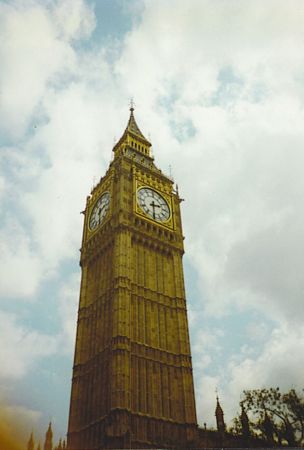
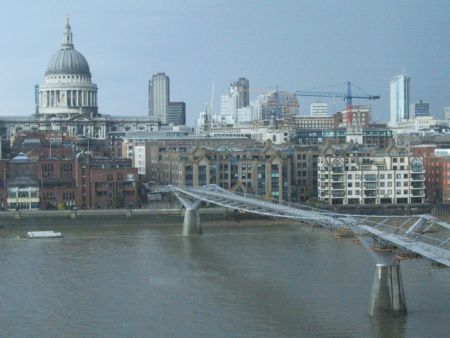
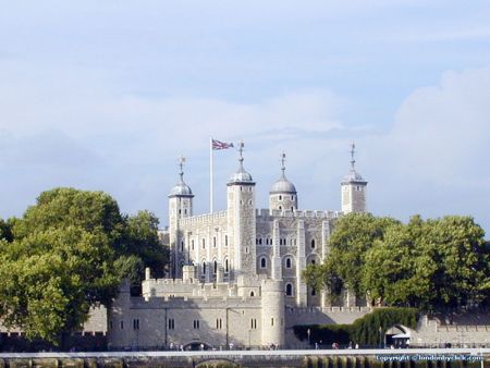
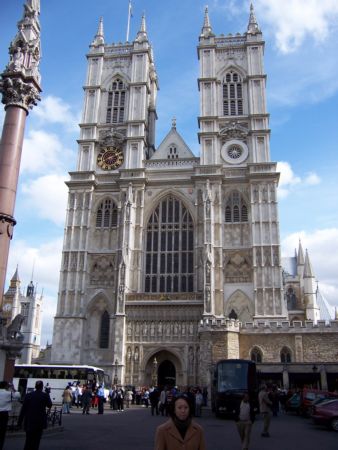
の写真 ロンドン
ロンドン, イギリス からの距離
報知的な材料 - イギリス
通貨 イギリス, ポンド
通貨の計算機 ポンド
大使館 イギリス
イギリスの地図
空港の一覧 イギリス
フォトギャラリー
イギリス, ロンドン
あなたの写真を追加
の写真 ロンドン »